As you may recall, I am in the process of writing a series of articles about riding/driving in Southern Arizona entitled "Riding SoAZ." It can be found on our scooter club website. I have been trying to use my own photos for all of it as well. (I haven't quite succeeded, but the vast majority are mine.) Well, I realized as was getting into the next few sections, that, not only do I not have any photos of much of the area, but I actually had never been to several of the locations as an adult. So, I decided to head out to far corner of southeastern AZ for pics and a feel for the territory.
Unfortunately, I could not ride my scooter. The first area I wanted to cover was to be about a 500 mile trip. I have gone that far on the scoot, but it would take too much time to do so in a single day. Add the fact that I needed to explore a bit AND take pictures and it is really out of the question for a 150cc scooter. So, in the mini-van I hopped.
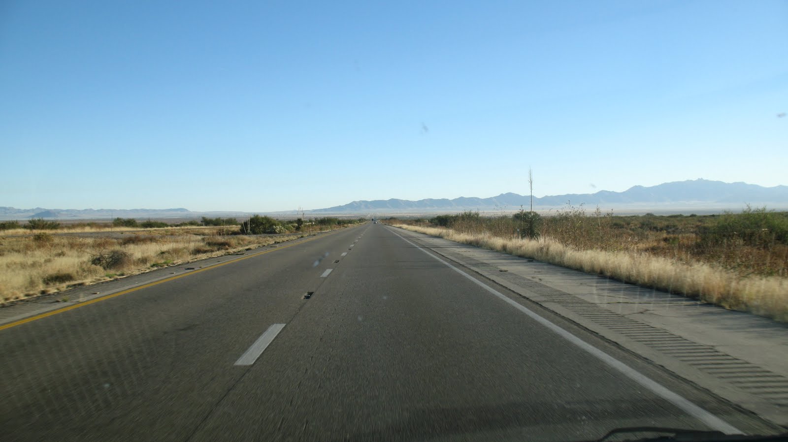 My travel pieces tend to ignore the interstates. Looking at the above pic taken between Benson and Willcox, can you blame me? However, I wanted to get to the area in question as quickly as possible, so I-10 it was. The plan was to go just into New Mexico and take Route 80 south. I wanted to go to the towns of Portal, Rodeo and Douglas first.
 When I got to San Simon, AZ, I saw a sign that said "Portal - 25 miles." Ever keen for an adventure, I exited the interstate and headed south on some black top, which as you can see above, quickly turned into dirt 4-5 miles later. No problem. At least you can see oncoming cars a long ways away by looking for dirt clouds.
 "Warning - Forest Road #42 Impassable to ALL vehicles over 28 feet long." At least the road would probably be fun to drive. Those are the Chiricahua Mountains in the background and Portal is located on the east side of them.
 As Yogi Berra says, "When you come to a fork in the road..... take it." So I did. I went left where the sign says it's 9 more miles to Portal. The road was a tad rough in spots, but the scenery was great.
I arrived in Portal with no difficulty. The Portal Store, Cafe' and Lodge is the main hub of activity. The store in tiny and there is no fuel. If you're headed this way on a smaller bike, gas up in Willcox or San Simon. There is also fuel at "Road Forks" which is where Rte 80 meets I-10. (Remember the original plan?"

I wonder how good the rock selling business is there? If you look very carefully, the sign also says "Free Local Delivery." That clinches it for me. I proceeded past Portal going west. I was also here to see Cave Creek and check it out as a possible scooter club destination.
 Yup, there's a creek here.
 Critters, too. That's a pair of little bucks scappin'. There were several other head in this little herd of mule deer as well. It was fun to watch.. I enjoyed the amazing scenery in the canyon, then went back through Portal, back to Route 80 and actually into New Mexico briefly.
 I was surprised to see this large monument on the road side. I looked at it closer and it the "Geronimo Surrenders" monument. Cochise was also very active in these parts.
If you closely in the center of this pic, it is said that Cochise's spirit is so strong, that you can see his face in the mountains. Can you see it?
 I continued south on 80, noticing old railway bridges on the west side of the road. I tried to get a pic of the old rail bed. Can you make it out in the pic above? I think I need to get a bit higher. I was standing on the side of the van, but it's just not enough. On in to Douglas I went.
 The Douglas police station is actually the old train depot. Very cool in my opinion. Douglas is right on the Mexican border. I had gone as far south as I could. Now my plan was to loop back up the west side of the Chiricahuas, up the Sulphur Springs Valley then over to the Chiricahua National Monument.
 There is a lot of farming and ranching the Sulphur Springs Valley. Afterward, I looked up some additional information about the area. One article said that they had solar powered irrigation here in 1904! Amazing!
 Just as you enter the national monument, there is a tiny cemetery. I love old cemeteries. This wouldn't be the last one of this trip, either.
 I began climbing and came into pine trees. I always love driving from desert into trees. The rapid change never ceases to amaze me.
 Chiricahua National Monument is known for it's amazing rock formations. They are everywhere.
 I managed to wave to myself.
 I snagged the pics I wanted, and headed back to Tucson. It was a lovely trip. It would have been better on a scooter, but I'm trying to remedy that as well. I am in the process of trying to sell one scooter, in order to buy a bigger, faster scoot. I'll let you know how that goes.
I actually took these pics on 11/8. today I took another, similar drive today, 11/8. I'll try to post those and the associate adventure, tomorrow.
Ride on,
Howard
Howard:
ReplyDeleteI just love photos of these out of the way places. Not every trip can be on two wheels. I don't like gravel very much. It is easier to slide on 4 wheels.
bob
Wet Coast Scootin