Friday, November 26, 2010

Arizona Adventures Part III

I left off last time at the Coronado National Monument just below Geronimo Pass. The Nice lady at the visitor center and I talked for a while. She asked what my plans were and I told her that I was just out exploring for the day. She asked how I felt about birds. I told her that I'm not a bird watcher per se, but that they're okay.

She asked how I felt about Sandhill Cranes. I have fond memories of them when I was little, growing up in Roswell. The Sandhills would land in out fields every fall. I commented that I didn't think they would be here yet on their annual migration. She replied that there were several thousand in the area already and gave me directions.

I had to go through Bisbee, then on to the north and east of there. I was already planning on going to Bisbee, so decided, "What the heck, might as well." So off I went.

I left the park, til I hit Route 92 and turned toward Bisbee. The first little town is Palominas, AZ. I don't know what this domed building was originally built for, but it is deserted now. The sign at the entrance has only the word "church" on it, and that probably wasn't what it was originally anyway.
Several months ago, there was an article about Jimmy's Hotdog in Arizona Highways. I love hot dogs and when I drove past Jimmy's on my way into Bisbee, I made a u-turn and went back.
(Click on any picture to enlarge it.) I ordered a Chicago Dog and a Frito Pie. Both were very good.
That's Jimmy. He and his family are from Chicago and they "import" virtually everything they serve from the Chicago area to make sure it is as authentic as it can be. I love it. If you're now living here in Arizona and are pining for some real Chicago foods, go to Jimmy's.
After my tasty meal at Jimmy's, I meandered over to Central Highway. Passing this little house with a gallows with noose outside, resulted in another u-turn and a couple of pics. Is it left over from Halloween, or is it some kind of warning?
Are a couple more miles of dirt road, I found the sanctuary where the Sandhills reside for the winter. Most of them are out feeding for the day, but there were still several hundred here. They are impressive bird with wingspans up to 8 feet.
I had decided not to return to Bisbee. I checked out my map and saw to road that led back west to Tombstone. I had never been on either one and picked the one which appeared, on the map, to be a bit more windy. Gleeson Road was a few mile north of the bird area. I could return the way I came, but, instead, decided to follow another dirt road which went in a northerly direction. Not to bring politics into my blog, but I did come upon a couple of asses.
I passed this cool looking church on my previous adventure to the southeast corner of the state.
I turned on Gleeson Road and found this freshly dead rattle snake. It's just a foot or so long.
Gleeson is a ghost town. I don't know what this used to be, but it was pretty big. It had a nice pair of columns at its entrance.
The old dry goods store is still in pretty good shape.
Here is another one of the buildings. In the top right corner of it's front are the words "Joe Bono." I'm not sure what happened to Joe, but the building his business used to be in, is one of the few left in Gleeson.
The cemetery is very large. Surprisingly, there were headstones as new as 2002. I guess people who used to live here, wanted to buried here. Gleeson must have been a nice place where fond memories were formed.
Here's another view of the cemetery. Shortly after leaving Gleeson, the road turned to dirt. I continued driving toward Tombstone. I got the feeling that the van was making sounds it didn't usually make.
I stopped to look around and found that I had a flat. Well, I knew I didn't have a jack, because the one that came with the van broke the last time I changed a tire. Secondly, I was in the middle of nowhere, and didn't feel that I could get a service truck to my location. I decided to drive on it until I was close to Tombstone. Long story short, I drove til I hit pavement, the 3rd car that came past stopped, went and got a jaw and I put my spare on and started driving toward home.
I took Route 82 back toward Sonoita, because I didn't want to take the spare on 75mph interstate. Shortly after turning onto 82, you pass the ghost town of Fairbank. Quite a few of the buildings are still here, including the original schoolhouse.
I liked the late afternoon light. Look carefully and you can see the nearly full moon above this old building.
Here's the moon again above the hills.
I liked the way the shadows were falling on the sides of the hills.

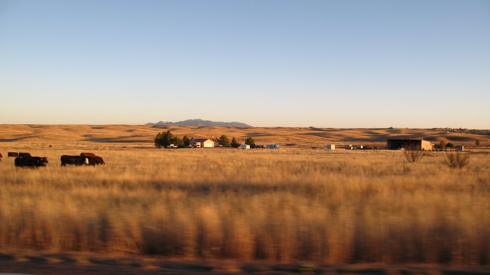
Amber waves of grass with grazing cattle in the late afternoon.

This completed my little adventure. I got new tires a few days later so I'm ready for the next drive. My wife wants to come along next time. That should be fun.

I hope you enjoy the photos. If you want more specific directions to any of these places, drop me aline.

Ride on,

Howard

Tuesday, November 23, 2010

Arizona Adventures Part II

The week after driving out to the far southwest corner of Arizona to get pics for my travel blog and to scout some territory for possible upcoming scooter rides, I decided to do another ride, just a tad bit closer to home. this route would take me almost due south very near the Mexican border, then east, around the south side of the Huachuca Mountains, east to Bisbee, then north(ish) to Tombstone and then lazily returning home. Like the previous week's trip, I was taking my van.

I had ridden to Parker Canyon Lake almost a year ago as an early training run for the Iron Butt ride. In looking at the map, I had noticed that there was a very minor road that went south of there and looped back to the east and came out near Sierra Vista. I didn't have the time, then, to ride it, but i logged that info for another day. That day had come.

The ride down Scenic Route 83, aka Sonoita Highway, is always beautiful. Sonoita is Arizona wine country. There are rolling hills, which (this time of year) are covered with amber waves of tall brown grass.
How many vineyards have a large yucca in the middle of them?

Once I got to Sonoita, I decided to check out a detour around to Elgin, AZ, which is the center of the wine growing area. I don't drink wine, but having spent some of my early years on a farm, I can appreciate agriculture. The drive around Upper Elgin Road did not disappoint me. I had been here before, but once I got to Elgin's only significant intersection, I turned due south. My Arizona map told me that turning either way would return me to Route 83, so I went the way I had never been before.

I reached 83 and continued south, toward Parker Canyon Lake. Our scooter club in contemplating a camping ride there in the spring, so I wanted to check it out, with that in mind.

Not far from returning to 83, I passed through the quasi-ghost town of Canelo. The road begins to climb along the west wall of Lyle Canyon. I snapped a couple pics looking down into the canyon and drove on.


I approached what is one of my favorite areas. There is a ranch house which these beautiful corrals, which look like they are 100 years old. There are some stone walls around there as well.

The road narrows significantly here and the road begins to climb along a series of tight switchbacks. It would be treacherous here if there were ice on the road. Since it is around 5000 feet elevation, ice would be a real possibility in the winter.

A long straight stretch of dirt.

I drove around the lake, took mental notes and took some pics.
Looks like it will be a good place. Now it was back to the point I had seen on the map; the place where my adventure began.

I knew from Google Maps that the bottom end of route 83 was dirt.

I came across a snake sunbathing in the road.

There is a little community around the lake. After only a couple of miles, I had left most of the signs of civilization (except the road, of course) behind.

I don't know how old the bridge is, but it looked cool.
As I reached the top of a hill, I could see a large expanse of grassland off to the southwest.
As the road continued, the scenery became increasingly amazing.

You can see the road I came in on going down the side of the mountain.

Pics don't do it justice, but as I gained elevation and could see more and more of that grassland area, it was reminding me of Africa. I was imagining elephants, giraffe and lions roaming around down there. It was incredible.

I passed the sign that told me I was gazing down into the San Rafael Valley.


I finally reached the top of what I now know is called Montezuma Pass. The view from this point was astounding!

Scary signs like this are everywhere.

I had a nice conversation with a young Army private who is assigned to an observation post (O.P. as we called them in the Army) at the top of the pass where they can look directly down in to Mexico and watch for illegal activity. I asked how much further it was to asphalt and was told it was less than 10 minutes.

It was more like 15 minutes and the went down a series of wicked switchbacks, but it sure was fun. There was stream trickling down the middle of this little canyon.

Down at the bottom of this is the visitors' center.
Border Patrol agents cruising on their ATV's.

I passed a sign that said something about a trailhead that leads to Coronado Cave, then I arrived at the Coronado National Memorial visitors' center.

Top center of this pic is Geronimo Pass as seen from the east side.
The rangers there were exceedingly kind and helpful. I mentioned the fact that they were kind of off the beaten path and she replied with a smile, "No one EVER comes here by accident." she is very right. You have to make the decision and plot your route to come here, but it is SOOOO worth it. I don't know when I'll get back, but I am sure looking forward to it.

This was only the first half of my adventure that day. Two more ghost towns, sandhill cranes, Chicago come to live in Bisbee and a blowout were in the next part of that day.

Ride on,

Howard

Thursday, November 18, 2010

Arizona Adventures Part I


As you may recall, I am in the process of writing a series of articles about riding/driving in Southern Arizona entitled "Riding SoAZ." It can be found on our scooter club website. I have been trying to use my own photos for all of it as well. (I haven't quite succeeded, but the vast majority are mine.) Well, I realized as was getting into the next few sections, that, not only do I not have any photos of much of the area, but I actually had never been to several of the locations as an adult. So, I decided to head out to far corner of southeastern AZ for pics and a feel for the territory.

Unfortunately, I could not ride my scooter. The first area I wanted to cover was to be about a 500 mile trip. I have gone that far on the scoot, but it would take too much time to do so in a single day. Add the fact that I needed to explore a bit AND take pictures and it is really out of the question for a 150cc scooter. So, in the mini-van I hopped.
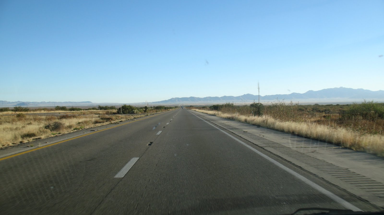
My travel pieces tend to ignore the interstates. Looking at the above pic taken between Benson and Willcox, can you blame me? However, I wanted to get to the area in question as quickly as possible, so I-10 it was. The plan was to go just into New Mexico and take Route 80 south. I wanted to go to the towns of Portal, Rodeo and Douglas first.
When I got to San Simon, AZ, I saw a sign that said "Portal - 25 miles." Ever keen for an adventure, I exited the interstate and headed south on some black top, which as you can see above, quickly turned into dirt 4-5 miles later. No problem. At least you can see oncoming cars a long ways away by looking for dirt clouds.
"Warning - Forest Road #42 Impassable to ALL vehicles over 28 feet long." At least the road would probably be fun to drive. Those are the Chiricahua Mountains in the background and Portal is located on the east side of them.
As Yogi Berra says, "When you come to a fork in the road..... take it." So I did. I went left where the sign says it's 9 more miles to Portal. The road was a tad rough in spots, but the scenery was great.
I arrived in Portal with no difficulty. The Portal Store, Cafe' and Lodge is the main hub of activity. The store in tiny and there is no fuel. If you're headed this way on a smaller bike, gas up in Willcox or San Simon. There is also fuel at "Road Forks" which is where Rte 80 meets I-10. (Remember the original plan?"

I wonder how good the rock selling business is there? If you look very carefully, the sign also says "Free Local Delivery." That clinches it for me. I proceeded past Portal going west. I was also here to see Cave Creek and check it out as a possible scooter club destination.

Yup, there's a creek here.
Critters, too. That's a pair of little bucks scappin'. There were several other head in this little herd of mule deer as well. It was fun to watch.. I enjoyed the amazing scenery in the canyon, then went back through Portal, back to Route 80 and actually into New Mexico briefly.
I was surprised to see this large monument on the road side. I looked at it closer and it the "Geronimo Surrenders" monument. Cochise was also very active in these parts.

If you closely in the center of this pic, it is said that Cochise's spirit is so strong, that you can see his face in the mountains. Can you see it?
I continued south on 80, noticing old railway bridges on the west side of the road. I tried to get a pic of the old rail bed. Can you make it out in the pic above? I think I need to get a bit higher. I was standing on the side of the van, but it's just not enough. On in to Douglas I went.
The Douglas police station is actually the old train depot. Very cool in my opinion. Douglas is right on the Mexican border. I had gone as far south as I could. Now my plan was to loop back up the west side of the Chiricahuas, up the Sulphur Springs Valley then over to the Chiricahua National Monument.
There is a lot of farming and ranching the Sulphur Springs Valley. Afterward, I looked up some additional information about the area. One article said that they had solar powered irrigation here in 1904! Amazing!
Just as you enter the national monument, there is a tiny cemetery. I love old cemeteries. This wouldn't be the last one of this trip, either.
I began climbing and came into pine trees. I always love driving from desert into trees. The rapid change never ceases to amaze me.
Chiricahua National Monument is known for it's amazing rock formations. They are everywhere.
I managed to wave to myself.
I snagged the pics I wanted, and headed back to Tucson. It was a lovely trip. It would have been better on a scooter, but I'm trying to remedy that as well. I am in the process of trying to sell one scooter, in order to buy a bigger, faster scoot. I'll let you know how that goes.

I actually took these pics on 11/8. today I took another, similar drive today, 11/8. I'll try to post those and the associate adventure, tomorrow.

Ride on,

Howard


Tuesday, November 9, 2010

Fall Classic Frenzy

This past Friday and Saturday I attended my 5th scooter rally of 2010. For someone who has said he's not really into rallies, I sure went to a lot of them. Well, five seems like a lot to me. I went to one two years ago and two last year.

This one was the Fall Classic, aka the Tucson-Nogales Rally. This it's 23rd year which, I'm told, makes it one of the nation's longest running rallies. It is a weekend "camping rally." For many years the rally started with a Meet & Greet at the historic Hotel Congress in downtown Tucson. Due, in part, to recent renovations, there is no longer as much room for scooters as in the past, so it was moved to "The Hut."

The Hut, obviously, is a tiki-themed bar on 4th Ave. The giant tiki head was moved to here from a local miniature golf course that closed. I think it's an awesome addition. Additionally, it's quirky enough to make it a perfect venue for quirky scooterists, don't you think?

The 2008 Fall Classic was the first rally I ever attended. I enjoyed looking at all the scoots, but didn't really feel like a part of it. After almost 3 years of riding, I finally know enough other scooterists to feel more like a part of things. I've never had any desire to camp with the rally, but after feeling welcomed into "the fold," I may be willing to give it a try next year.

The meet and greet was great fun. We had some DJ's spinning classic northern soul music. Clubs from around the southwest were present. I got to meet some new people and see some scooter folk I hadn't seen in quite a while.

Saturday morning is when the "Nogales" part of the Tucson-Nogales Rally happens. Nogales, AZ is about 50 miles south of Tucson on I-19. Every year the rally makes that 50 miles into about 100 by riding east to Vail, then south, through Arizona wine country, to Sonoita, then back west to the campground. It is a beautiful ride and the weather was perfect. temps were in the upper 70's. But it was not to be a perfect ride for me. . . . . . . . (Insert suspenseful music here)

Iron Buddy and I set up to shoot a short video of the ride out from the Hut. I pulled into the rear of the group after they all passed me, then got stuck at a light. There were a couple of other lights that I got stopped at, so when I finally hit Aviation Parkway, I hammered the throttle to catch up. I had gone a mile or so and was just catching the back of the pack when my drive belt exploded and Iron Buddy and I coasted to a stop.

I figured my day and the rally were lost. The Scoot Over sag wagon pulled up and when they told me that they had no replacement belts on board, I knew I was done. As Jason pulled away, he told me the shop was open and to give Ron a call.

As I began pushing my poor scooter to a main street so that I could be found more easily, my phone rang. It was Ron, at Scoot Over. He told me not to worry and that they were sending the truck over to help me get back on the road. Huzzah!

Long story - short: I got picked up, got to the garage where we replaced the belt. We called and found out where the group was and I left trying to catch up. I didn't make it out of the parking lot and the rear wheel locked up. DRAT! Limped back to the garage where we found that my NCY performance clutch was jacked up. We replaced the clutch with a stock one and off I went again, almost an hour behind the pack.

The ride stops in Vail for 20-30 minutes, then again in Sonoita for 20-30 minutes before riding into the Campground near Nogales. I figured if I ran really hard, I might could catch the group at Sonoita. I rode the shortest way I knew and I actually caught them in Sonoita. It was a glorious sight when I topped the hill and saw all those beautiful scooters!

Unfortunately, they were pulling out just as I pulled in. I was hungry, thirsty and in need of fuel. I addressed all three areas and raced out of town. "I caught 'em once, I'll catch 'em again" i thought as I began to ride. And i did catch them about 10 miles outside of Nogales. I kept passing scooters until I caught up with John, who was riding my Stella (another story of broken scoots.) We rode together to the campground.

I was having a great time. There was the human taco (a Pharoes prospect)

Here's one of the "Rally Dogs." He came up with Jason in the SAG wagon.
Here's much of the camp as seen from the hill to the south.
Ahhh! the chuckwagon. This was the first year I hung out long enough to eat. It was pretty darned tasty.

After running WOT up I-19 for 45 miles, Sean's Riva finally asked for a break.

There was a beautiful sunset that evening. Sean and I got a great view as we waited for his scoot to cool down.

I would have preferred to have ridden WITH the rally all the way. It is nice, however, to know just what the Iron Buddy can do. I hope to make it to five more rallies in 2011, but I don't know if I will. I do know that I will attend the 20011 Fall Classic and I'll be looking forward to it.

By the way, here is the unedited video of the ride out, that wound up putting me at the back of the pack.


Ride on,

Howard